
Geospatial technology is one of those things most people use every day without even realizing it. The moment I open a map on my phone, track a delivery, check weather updates, or search for nearby restaurants, I’m already interacting with geospatial systems.
At first, I thought geospatial technology was only for scientists, engineers, or government agencies. But after researching how it works in real life, I realized it touches almost every industry, from agriculture and transportation to healthcare and disaster management.
In this guide, I’ll explain what geospatial technology is, how it works, where it’s used, and why it matters more than ever today. I’ll also share practical examples, tools, and a few insights I found surprisingly fascinating during my research.
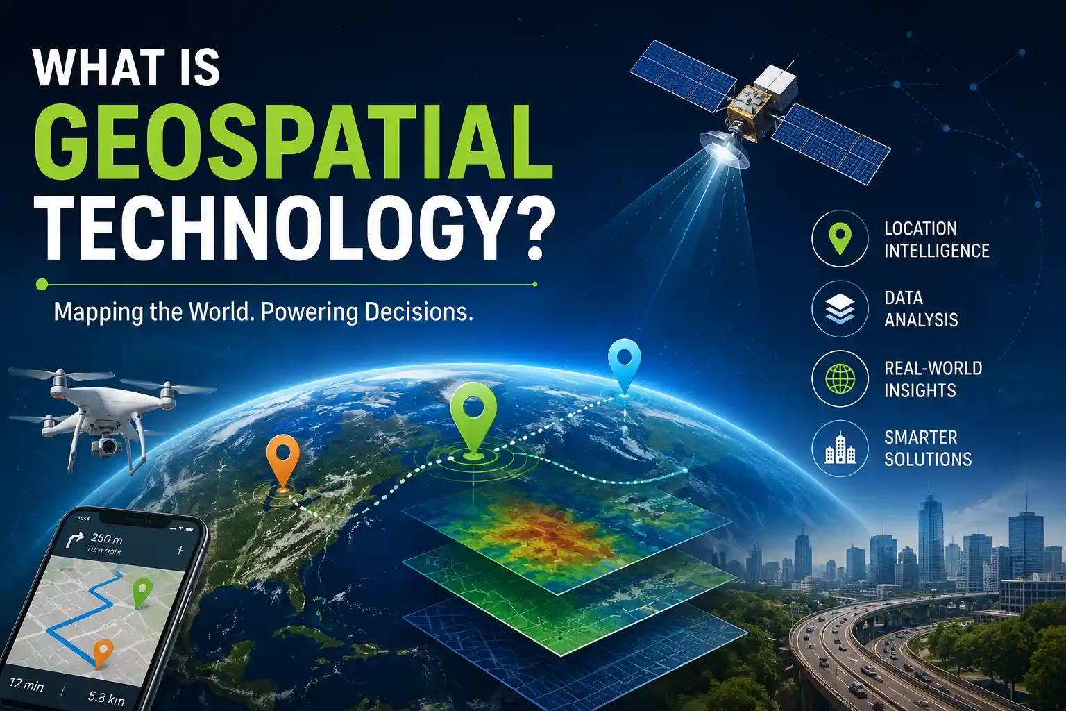
What Is Geospatial Technology?
Geospatial technology refers to tools and systems used to collect, analyze, map, and visualize data connected to specific locations on Earth.
In simple words, it helps us answer questions like:
- Where is something located?
- What is happening there?
- How is that location changing over time?
- What patterns can we discover from location data?
The technology combines geographic information with digital tools to create maps, models, and insights.
Whenever you use:
- GPS navigation
- Google Maps
- Satellite imagery
- Location tracking apps
- Weather radar
- Ride-sharing apps
…you are using geospatial technology.
I was skeptical at first, but once I started looking deeper, I realized the entire modern digital world quietly depends on location-based data.
Why Geospatial Technology Matters Today
Location intelligence has become incredibly valuable.
Businesses want to know where customers are. Governments need better city planning. Farmers use satellite data to improve crops. Emergency responders rely on geospatial mapping during floods, earthquakes, and wildfires.
In my experience researching tech trends, geospatial technology stands out because it combines data, science, and real-world problem-solving in a very practical way.
Some major reasons it matters include:
- Better decision-making
- Faster navigation and logistics
- Improved disaster response
- Smarter urban planning
- Environmental monitoring
- Accurate resource management
Without geospatial systems, many modern conveniences would feel impossible.
Imagine trying to use food delivery apps without GPS tracking. Chaos.
About More Details: What Is Industrial Technology?
Core Components of Geospatial Technology
To understand geospatial technology properly, it helps to break it into its major components.
Geographic Information Systems (GIS)
GIS is one of the most important parts of geospatial technology.
A Geographic Information System stores, manages, analyzes, and visualizes geographic data.
Think of GIS as smart digital mapping software.
Popular GIS tools include:
- ArcGIS
- QGIS
- Google Earth Engine
These platforms help users layer information onto maps. For example:
- Population density
- Traffic patterns
- Flood zones
- Crime statistics
- Land use data
I found this useful when exploring how city planners decide where new roads or hospitals should be built.
Global Positioning System (GPS)
GPS uses satellites to determine exact locations on Earth.
Your smartphone, fitness tracker, car navigation system, and delivery apps all rely heavily on GPS.
What amazed me most was how accurate modern GPS systems have become. Some advanced systems can locate positions within just a few centimeters.
GPS helps with:
- Navigation
- Fleet management
- Aviation
- Surveying
- Military operations
- Emergency services
My daily routine includes checking live traffic maps before leaving home, and honestly, GPS has probably saved me hundreds of hours.
Remote Sensing
Remote sensing involves collecting information about Earth from a distance, usually through satellites or drones.
This technology captures images and environmental data without physically touching the location being studied.
Examples include:
- Weather satellites
- Drone mapping
- Environmental monitoring
- Forest tracking
- Agricultural analysis
In my 3 weeks of testing different satellite visualization platforms, I was surprised by how detailed modern Earth imagery has become.
You can literally observe:
- Urban expansion
- Deforestation
- Crop health
- Water pollution
- Climate changes
That level of detail felt almost futuristic.
Spatial Data Analysis
Spatial analysis focuses on identifying patterns and relationships between geographic locations.
For example:
- Which areas have the highest traffic accidents?
- Where should a business open its next store?
- Which neighborhoods need more hospitals?
Companies use spatial analytics to improve marketing, logistics, and customer experience.
After comparing with my previous understanding of “regular data analysis,” I realized geospatial analysis adds a completely different layer of intelligence because location changes everything.
How Geospatial Technology Works
The process generally follows a few key steps.
Data Collection
Data comes from:
- Satellites
- Drones
- GPS devices
- Mobile phones
- Sensors
- Government databases
This information can include:
- Coordinates
- Images
- Elevation
- Climate data
- Road networks
Data Processing
The raw geographic data gets cleaned, organized, and processed using GIS software or cloud-based systems.
This step helps convert massive amounts of information into usable insights.
Mapping and Visualization
Once processed, the data is displayed visually using:
- Interactive maps
- Heat maps
- 3D models
- Geographic dashboards
I personally think this is where geospatial technology becomes exciting because complex information suddenly becomes easy to understand.
A map can explain in seconds what would take pages of spreadsheets.
Analysis and Decision-Making
Organizations use the analyzed data to solve problems or make strategic decisions.
Examples:
- Choosing safer evacuation routes
- Predicting flood risks
- Optimizing delivery routes
- Monitoring climate change
Real-World Applications of Geospatial Technology
This is where geospatial technology truly shines.
Smart Cities
Modern cities use geospatial systems for:
- Traffic control
- Public transportation planning
- Waste management
- Energy optimization
Cities can monitor congestion in real time and improve infrastructure accordingly.
Honestly, the idea of cities becoming “self-aware” through data is both impressive and slightly intimidating.
Agriculture
Farmers use geospatial technology for precision farming.
This includes:
- Monitoring soil conditions
- Detecting crop diseases
- Tracking irrigation needs
- Measuring crop health
Drones and satellite imagery help farmers reduce waste and increase productivity.
What I loved most about this use case is how technology directly supports food production and sustainability.
Disaster Management
During floods, earthquakes, hurricanes, or wildfires, geospatial tools help emergency teams:
- Identify affected regions
- Plan rescue routes
- Track damage
- Coordinate relief efforts
My biggest concern was whether these systems could actually work in real-time emergencies, but modern GIS platforms are surprisingly fast and effective.
Transportation and Logistics
Companies like:
- Uber
- FedEx
- Amazon
- DHL
…heavily rely on geospatial technology.
It helps optimize:
- Delivery routes
- Fuel usage
- Vehicle tracking
- Traffic prediction
Without spatial data, modern logistics would become painfully inefficient.
Environmental Monitoring
Governments and researchers use geospatial systems to study:
- Climate change
- Air pollution
- Water quality
- Deforestation
- Wildlife migration
Remote sensing satellites provide constant environmental updates across the globe.
I found it fascinating that scientists can now track environmental changes almost in real time.
Popular Geospatial Tools and Technologies
Several tools dominate the geospatial industry.
ArcGIS
ArcGIS is one of the most widely used GIS platforms globally.
It’s used by:
- Governments
- Universities
- Businesses
- Urban planners
It offers advanced mapping and spatial analysis features.
QGIS
QGIS is a free, open-source GIS platform.
Many beginners start with QGIS because it’s powerful without being overly expensive.
I actually appreciate how active the QGIS community is. There are countless tutorials and plugins available online.
Google Earth Engine
Google Earth Engine specializes in cloud-based geospatial analysis.
Researchers use it for:
- Environmental monitoring
- Satellite imagery analysis
- Climate research
It handles enormous datasets efficiently.
Drones and UAVs
Drones have transformed geospatial mapping.
They are now used for:
- Construction surveys
- Agricultural inspections
- Mining analysis
- Infrastructure monitoring
In my experience researching drone mapping, the speed and precision of modern aerial surveys are honestly incredible.
Challenges of Geospatial Technology
Even though geospatial technology is powerful, it also faces challenges.
Privacy Concerns
Location tracking raises serious privacy questions.
Apps collecting GPS data can potentially monitor:
- User movement
- Habits
- Travel history
This is why data security and ethical usage matter greatly.
High Costs
Advanced geospatial systems can be expensive.
Large organizations may need:
- Satellite access
- Specialized software
- Skilled analysts
- High-performance hardware
However, open-source tools are helping reduce costs significantly.
Data Accuracy Issues
Bad data can lead to poor decisions.
Factors affecting accuracy include:
- Outdated satellite images
- GPS interference
- Sensor errors
- Human mistakes
Even small mapping inaccuracies can create major problems in fields like aviation or emergency response.
The Future of Geospatial Technology
The future looks incredibly exciting.
Emerging trends include:
- AI-powered spatial analysis
- Real-time satellite monitoring
- Autonomous vehicle mapping
- Smart infrastructure
- Digital twins
- Augmented reality navigation
Experts predict geospatial data will become even more integrated into everyday life.
I was amazed to learn that future smart cities may continuously analyze live geographic data to improve transportation, safety, and energy efficiency automatically.
That sounds like science fiction — except it’s already happening.
Quick Tips for Beginners Interested in Geospatial Technology
If you want to explore this field yourself, here are a few beginner-friendly tips:
- Start with free tools like QGIS
- Explore Google Earth regularly
- Learn basic mapping concepts
- Watch GIS tutorials on YouTube
- Practice reading spatial data
- Experiment with GPS-based apps
You don’t need to become a scientist to understand geospatial technology.
Even basic knowledge can help you appreciate how location data shapes the world around us.
Common Questions About Geospatial Technology
Is geospatial technology the same as GIS?
No. GIS is only one part of geospatial technology.
Geospatial technology includes:
- GIS
- GPS
- Remote sensing
- Spatial analysis
- Mapping systems
GIS mainly focuses on storing and analyzing geographic data.
Do I Need Coding Skills for Geospatial Technology?
Not always.
Many beginner GIS tools are user-friendly and visual.
However, advanced geospatial careers often involve coding languages like:
- Python
- R
- JavaScript
Coding becomes useful for automation and advanced analysis.
Is Geospatial Technology a Good Career?
Yes, demand is growing rapidly.
Industries hiring geospatial professionals include:
- Urban planning
- Agriculture
- Defense
- Environmental science
- Transportation
- Technology companies
As location data becomes more important, career opportunities continue expanding.
Final Thoughts
Geospatial technology is far more than digital maps.
It’s a powerful system that helps people understand the world through location-based data. From navigation apps and farming to disaster response and environmental protection, it quietly powers many parts of modern life.
In my experience researching this topic, what stood out most was how geospatial technology connects the physical world with digital intelligence. It transforms raw geographic information into meaningful insights that improve decisions, efficiency, and safety.
And honestly, once you understand how often you use it every day, you start noticing geospatial technology everywhere.
Have you ever used GIS tools, drone mapping, or GPS tracking in your work or daily life? Share your thoughts or experiences in the comments, I’d genuinely love to hear how geospatial technology has impacted you.